
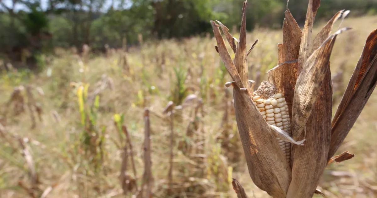
A reduction in rainfall is expected across the country in August, September, and October due to the influence of the El Niño phenomenon, according to the report “Climate Outlook August–November 2026” published by the Ministry of Environment and Natural Resources (MARN).
The institution explained in the document that “climatologically” this quarter is the rainiest of the season, and September and October see the highest rainfall accumulations; however, due to El Niño, the outlook is shaping up to be very different.
“For this year, 2026, in which El Niño conditions are present, the quarter will continue to see dry events, mainly in August and part of September, due to the extension of the midsummer dry spell. According to the forecast for excess rainfall events or storms, there is generally a low probability of occurrence, mainly due to the expected intensity of El Niño, as the warming of Pacific (Ocean) waters is expected to continue and reach its peak in the rolling quarter of October-November-December 2026,” MARN indicated.
The forecast also noted that periods of significant rainfall with “strong” electrical activity could occur, though they would be short-lived. Despite this, the Environment Ministry detailed, rainfall accumulations will remain below normal in most of the country, while in Ahuachapán, Sonsonate, Cabañas, and parts of La Libertad and Santa Ana, they will be within the expected range.
As for temperatures, the Environment Ministry specified in the report that they will remain elevated, especially in August due to the midsummer dry spell, with greater incidence in the afternoons and, in some cases, also at night. In addition, at least one heat wave event and one meteorological drought event are expected across the entire territory at the end of this month or early September.
“Due to this increase in temperatures, there is a medium probability, around 40 to 60%, of at least one heat wave event occurring during the month of August. The occurrence of at least one meteorological drought event nationwide is forecast with a low to medium probability (20 to 40%), with greater incidence in the municipalities located within the Central American Dry Corridor,” it stressed.
The average maximum temperature this quarter will be 30.5 degrees Celsius and the mean 24.6; the minimum, 20.3.
TOWARD THE DRY SEASON
The Environment Ministry reported that the transition to the dry season is expected in the second half of October, with the dry season fully setting in by the end of that month or early November.
Meanwhile, regarding northerly winds, the forecast indicated that there could be one episode in October (the normal average is two); in November, there would be 2 to 4 (the expected range is 1 to 5).
The next update to this report will be in November.
La Prensa Gráfica: https://www.laprensagrafica.com/elsalvador/el-nino-reducira-las-lluvias-en-este-trimestre-en-el-salvador-20260807-0086.html
El Niño: ola de calor, un evento de sequía y reducción de lluvias para este trimestre en El Salvador, prevé el MARN
Graciela Aguilar
En agosto, septiembre y octubre se prevé una reducción de las lluvias en el país debido a la influencia del fenómeno de El Niño, esto según el informe “Perspectivas Climáticas Agosto-Noviembre 2026” publicado por el Ministerio de Medio Ambiente y Recursos Naturales (MARN).
La institución explicó en el documento que “climatológicamente” este trimestre es el más lluvioso de la época y en septiembre y octubre es donde más se presentan acumulados de precipitaciones, sin embargo debido a El Niño el panorama apunta a ser muy diferente.
“Para este año 2026, en el que las condiciones de El Niño están presentes, el trimestre continuará con eventos secos principalmente en agosto y parte de septiembre por la extensión de la canícula. De acuerdo al pronóstico de eventos de exceso de lluvia o temporales, en general existe una probabilidad baja de ocurrencia, principalmente por la intensidad esperada de El Niño, ya que se espera que el calentamiento de las aguas del (océano) Pacífico continúe y alcance su máximo en el trimestre móvil de octubre-noviembre-diciembre 2026”, indicó el MARN.
El pronóstico también señaló que podrían ocurrir periodos de precipitaciones significativas y con “fuerte” actividad eléctrica, aunque de corta duración. Pese a eso, detalló Medio Ambiente, los acumulados de lluvias se mantendrán por debajo de lo normal en la mayor parte del país; mientras que en Ahuachapán, Sonsonate, Cabañas y sectores de La Libertad y Santa Ana estarán dentro del rango esperado.
En cuanto a las temperaturas, Medio Ambiente precisó en el informe que estas se mantendrán elevadas, sobre todo en agosto debido a la canícula, con mayor incidencia por las tardes y, en algunos casos, también por las noches. Además, se espera al menos un evento de ola de calor y uno de sequía meteorológica en todo el territorio a finales de este mes o inicios de septiembre.
“Debido a este aumento de las temperaturas, existe una probabilidad media, alrededor del 40 al 60%, de ocurrencia de al menos un evento de ola de calor durante el mes de agosto. Se prevé con una probabilidad baja a media (20 a 40%) la ocurrencia de al menos un evento de sequía meteorológica a nivel nacional, con mayor incidencia en los municipios ubicados dentro del Corredor Seco de Centroamérica”, subrayó.
La temperatura máxima promedio en este trimestre será de 30.5 grados Celsius y la media de 24.6; la mínima, 20.3.
HACIA LA ÉPOCA SECA
Medio Ambiente informó que la transición a la época seca se prevé en la segunda quincena de octubre y el establecimiento pleno de la misma al final de ese mes o inicios de noviembre.
Mientras, con los vientos nortes el pronóstico indicó que en octubre podría haber un episodio (el promedio normal es de dos); en noviembre habría de 2 a 4 (lo esperado es de 1 a 5).
La próxima actualización de este informe será en noviembre.
La Prensa Gráfica: https://www.laprensagrafica.com/elsalvador/el-nino-reducira-las-lluvias-en-este-trimestre-en-el-salvador-20260807-0086.html